One of the most famous excursions in the Natural Park of the Western Valleys is the source of the river Aragón-Subordán and the Ibón de Estanés.

Aguas Tuertas
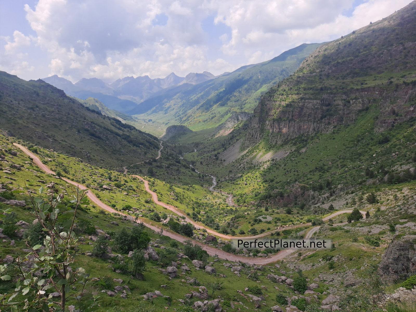
We start our route from the Guarrinza car park (it is small and it is advisable to arrive early). The asphalted road ends at the Mina car park, giving way to a fairly well-maintained track that allows access to Guarrinza for any car.
The Guarrinza car park is located about 7 kilometres from the Selva de Oza campsite.
Views
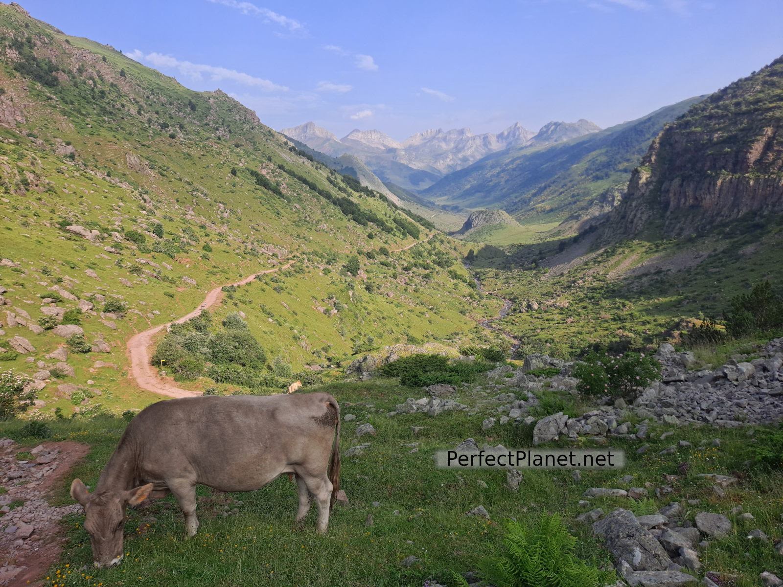
The first section of the route until you reach the unguarded refuge of Aguas Tuertas is a track accessible to authorised vehicles, although you can shorten the zigzags along the GR11 path.
Aguas Tuertas
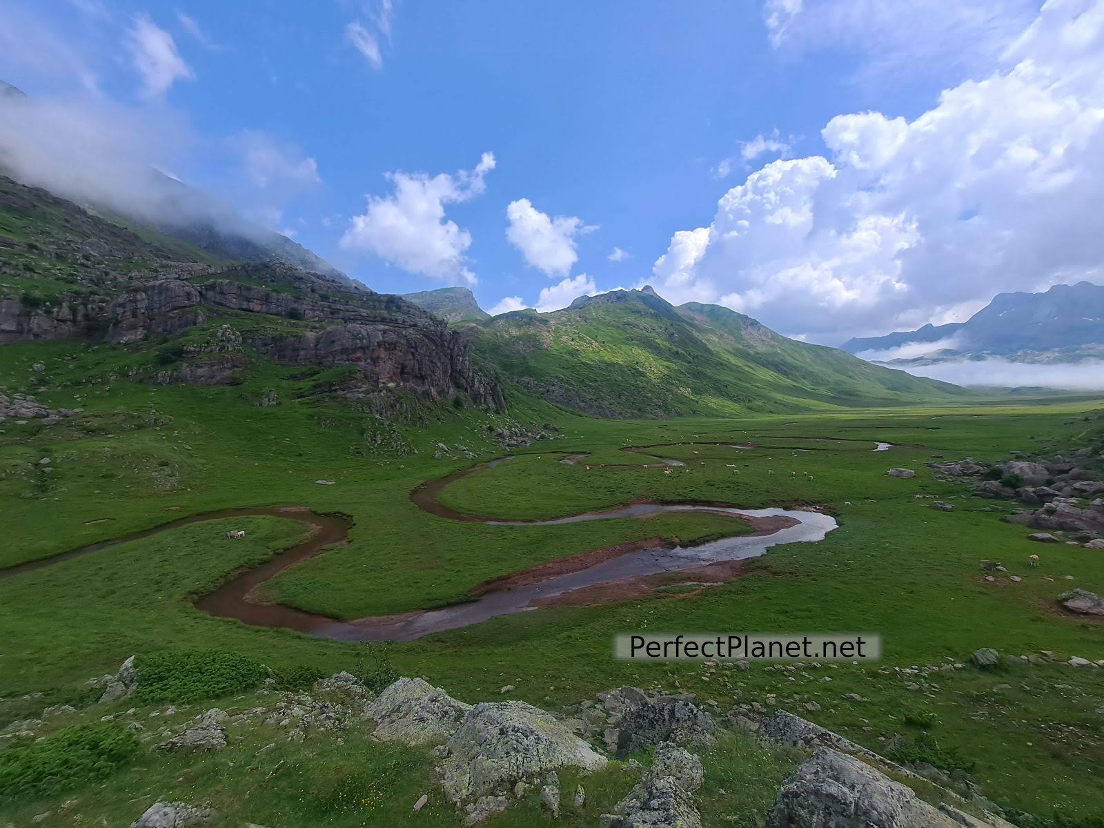
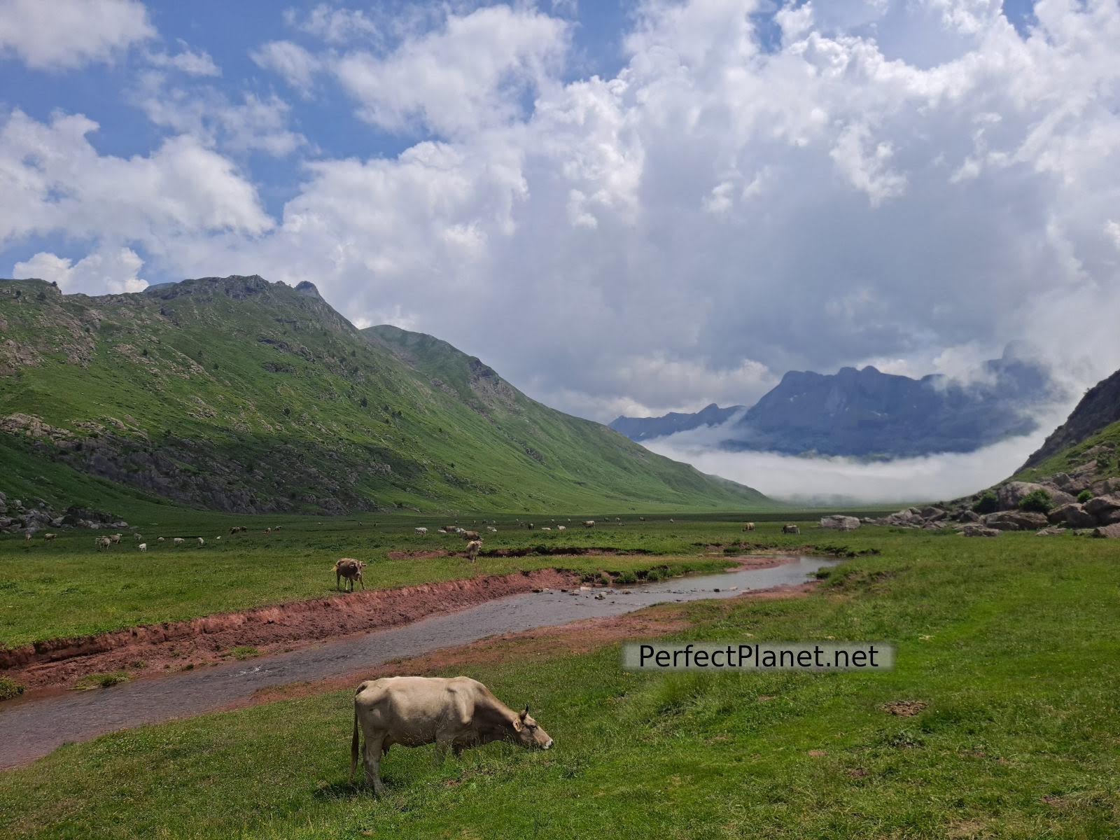
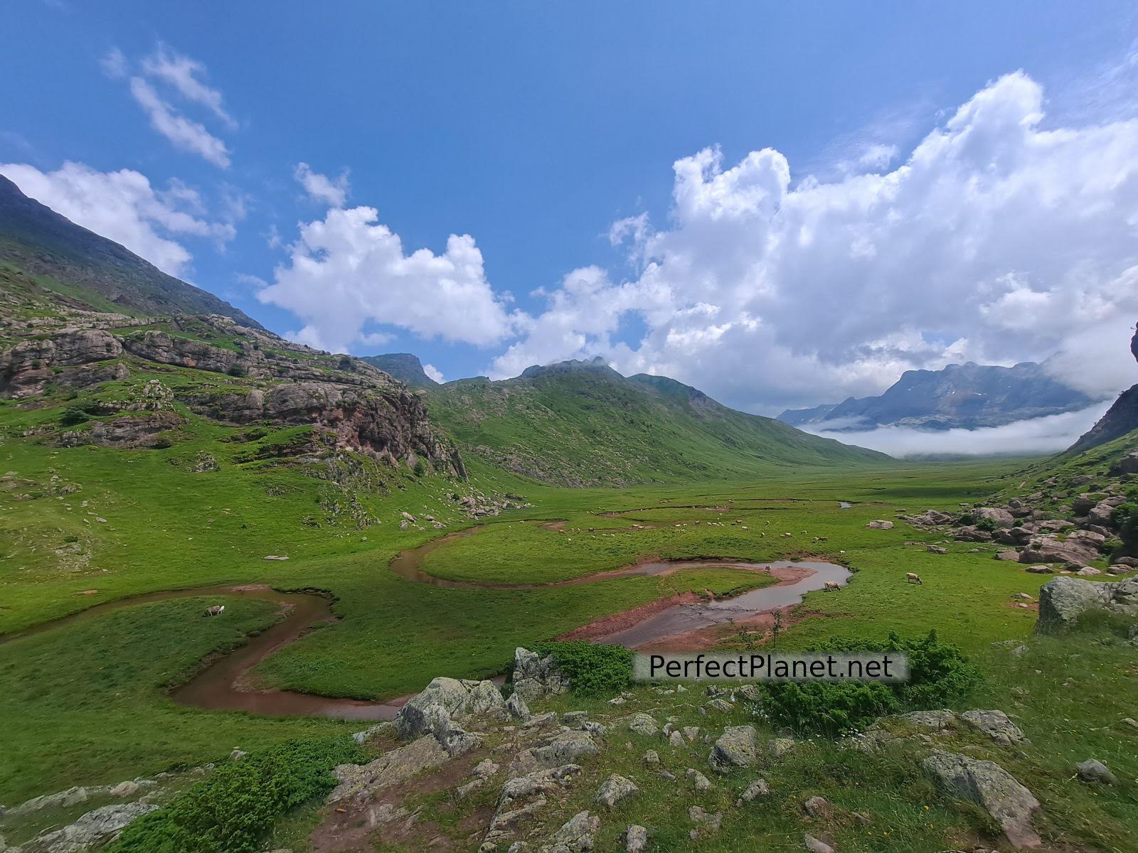
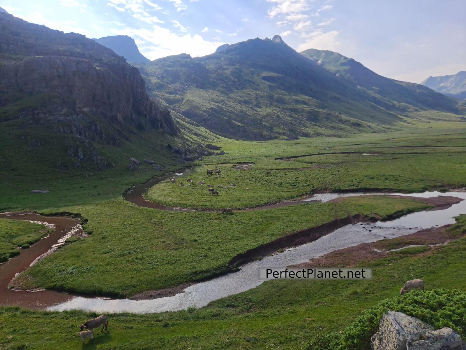
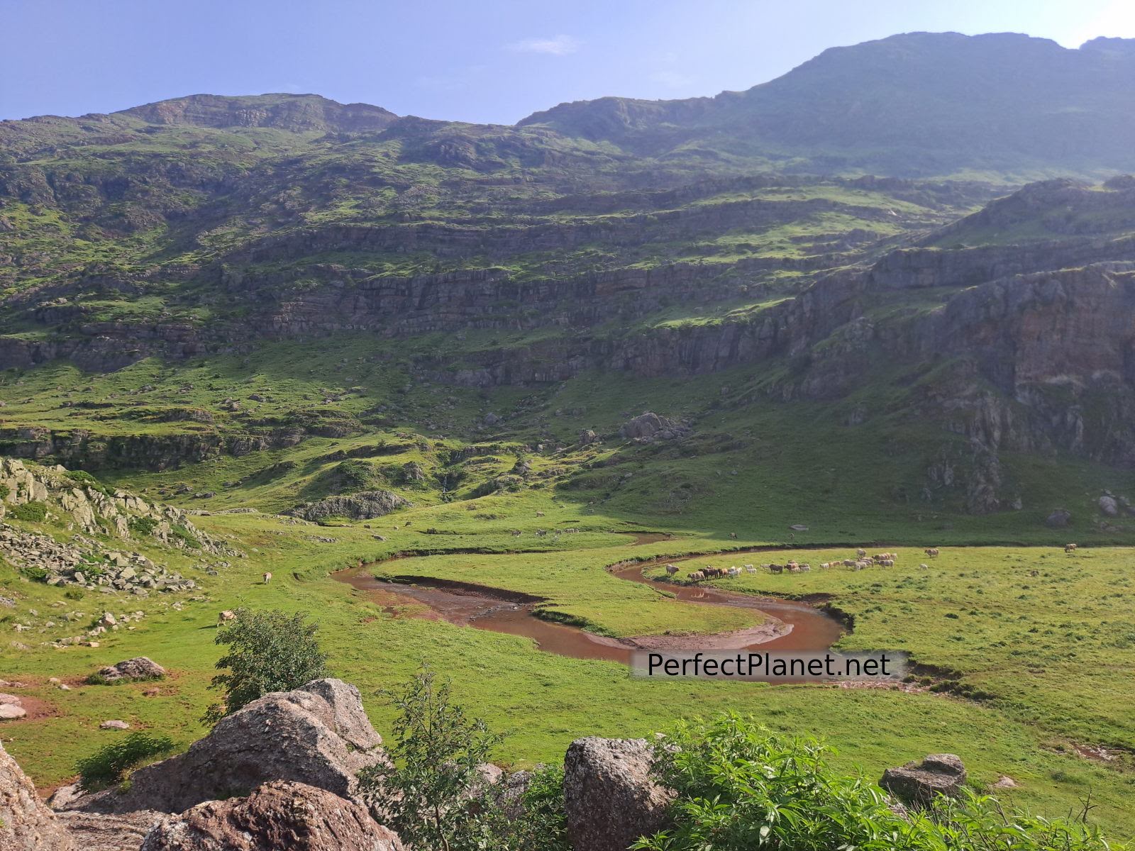
From the Aguas Tuertas refuge the views of the valley are spectacular. The way the river meanders through the valley is beautiful. Near the refuge on the left hand side you can visit the well-preserved Aguas Tuertas dolmen.
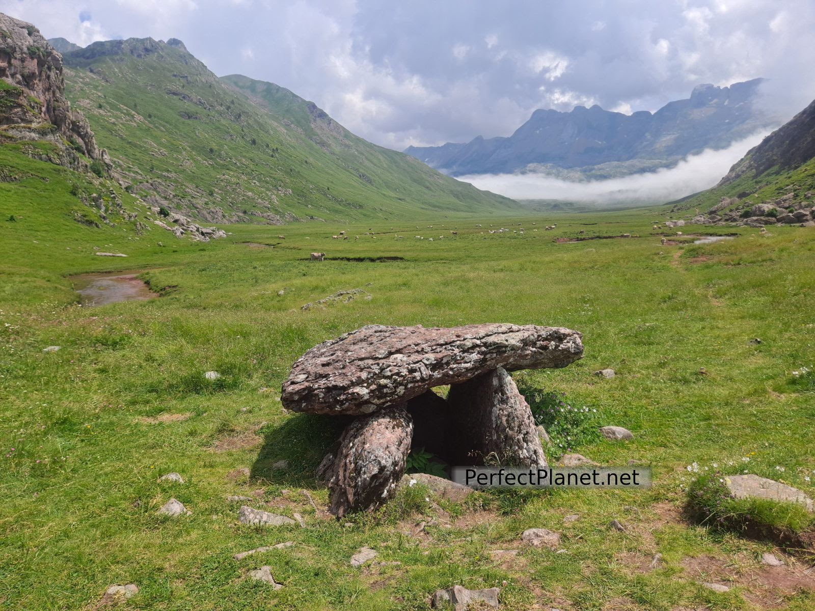
Dolmen
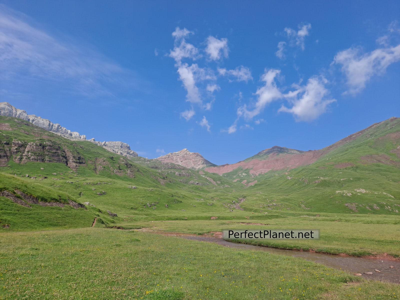
The route continues parallel to the river across the valley. On the last stretch you have to cross the river, if you head to the right there is a very easy step over stones, if the river is high all you have to do is take your shoes off.
Aguas Tuertas
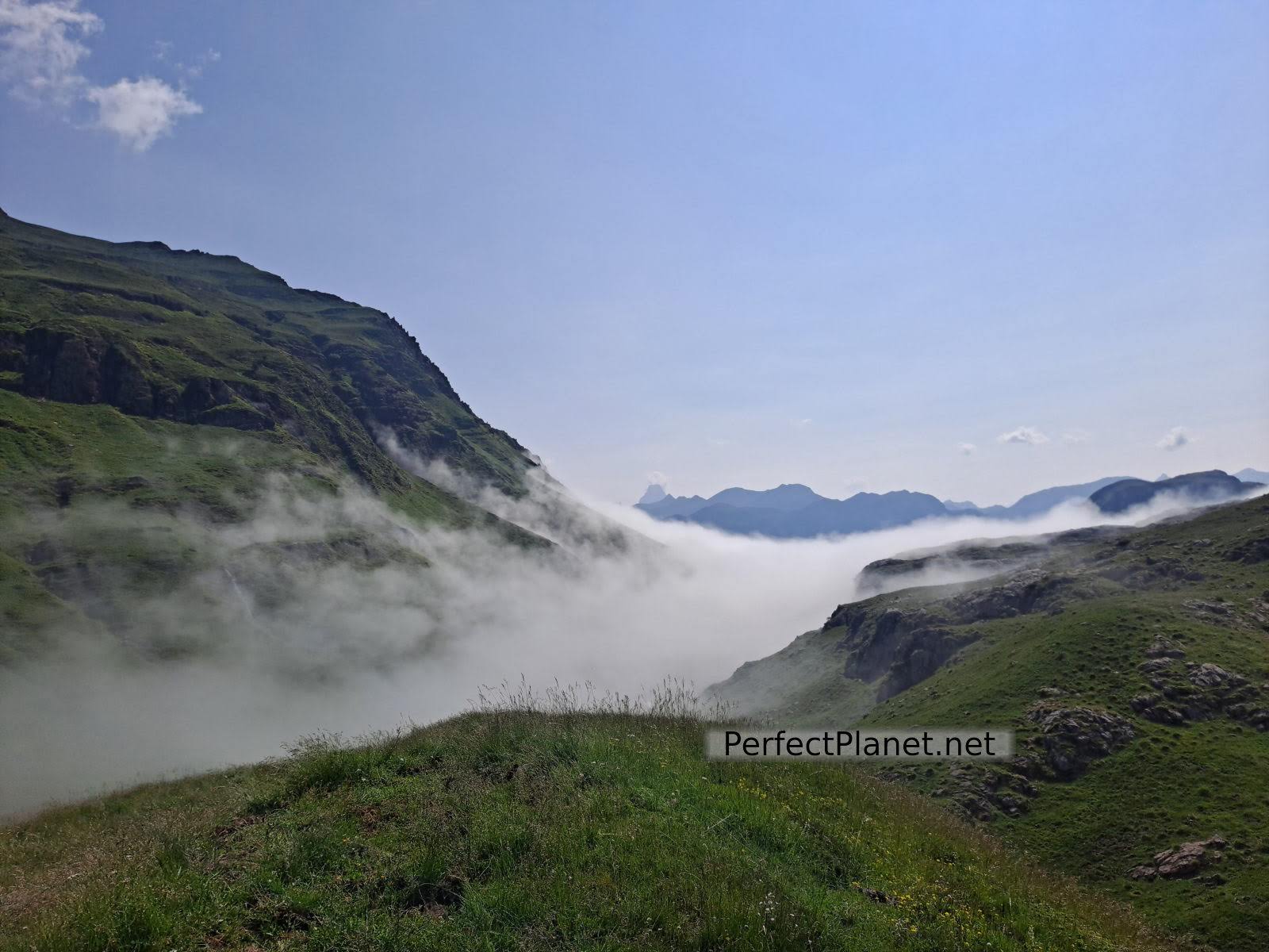
Once we have crossed the river we reach the natural viewpoint of Aguas Tuertas. From here we take the path on the right that leads us to the Estanés lake. If you continue straight on, you will reach the Escale pass, an important mountain pass dividing the border with France. This is a very foggy area due to the humidity.
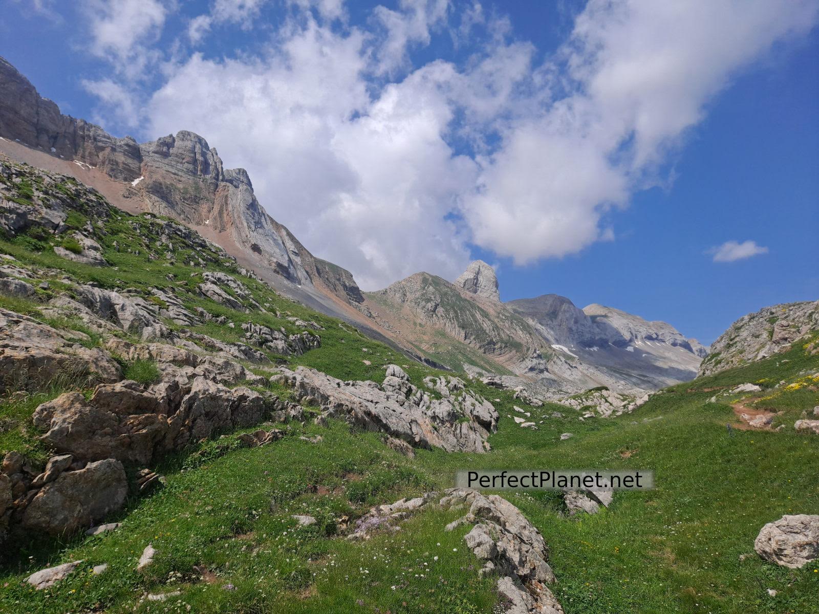
Continue in the direction of the lake to save the last 300 metres of height difference and reach the pass.
Aguas Tuertas
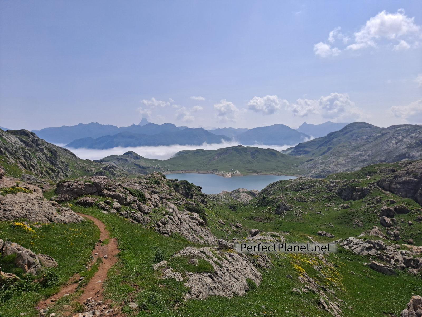
The Estanés lake, surrounded by imposing mountains, has glacial origins although it is currently dammed. A good place to stop for lunch.
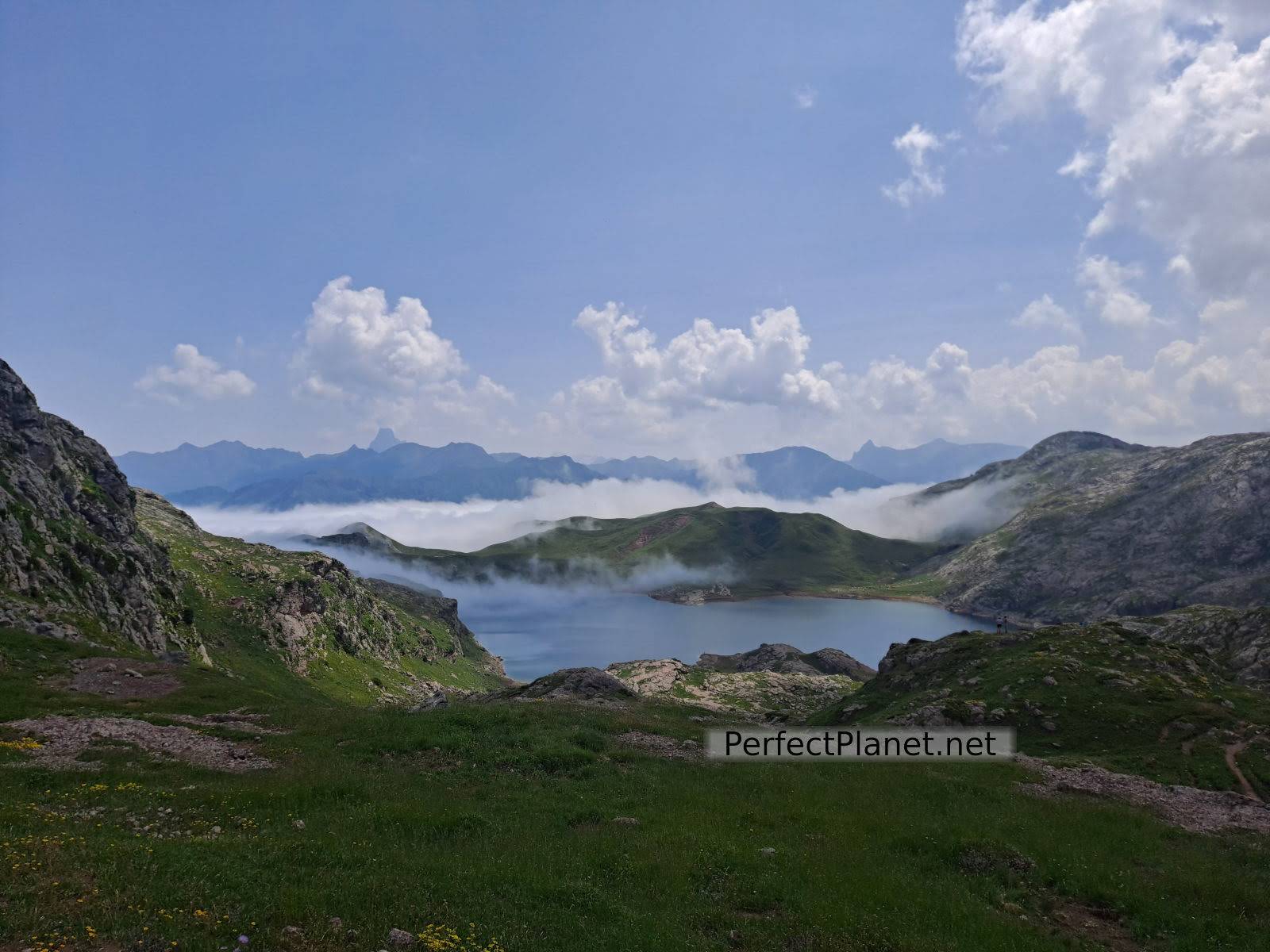
Estanés lake
We return along the same path to the Guarrinza car park.
Visews
It is a simple route that can be done with children.
Route: linear
Distance: 18 kilometres
Elevation gain: 700 metres
Track on Wikiloc
Difficulty: easy
Tips: if you do this route in summer remember that there is no shade or water along the whole route, so you should always be protected with sun cream and carry enough water. If you do the winter variant remember to bring full equipment, ice axe and crampons.
Whoever makes full or partial use of this track and its additional information, assumes full responsibility for the risks inherent in the practice of the activity, this information is for guidance purposes only.
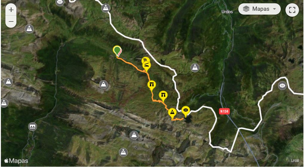
Map
You may be interested in
- Log in to post comments